
This article is 3 years old
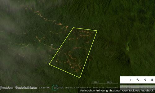
Satellite images show deforestation about a kilometre of Kenyir Lake

Satellite images of an area around Kenyir Lake show deforestation within a kilometre of the lake, which is inside a protected zone.
This comes as the Forestry Department in Terengganu denied illegal logging in the area, following a viral video of wood debris filling up the river near the lake.
Verifying user
RM12.50 / month
- Unlimited access to award-winning journalism
- Comment and share your opinions on all our articles
- Gift interesting stories to your friends
- Tax deductable