
This article is 3 years old
Limestone hills mapped amid concerns of destruction in quarries
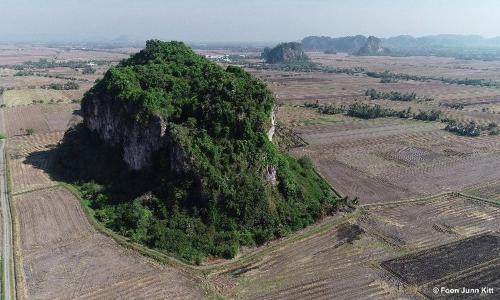
Researchers have now accurately mapped 1,393 limestone hills in Malaysia with the help of satellite images, drone technology and ground verification, in the hope that it can help preserve the key landscapes.
This public database included information on their location, biodiversity, surrounding land use and extent of habitat disturbance, which can be used to determine which hills warrant urgent protection.
The database launched is unrelated to but comes amid protests over quarrying operations at limestone hills in various parts of the country.
Verifying user
RM12.50 / month
- Unlimited access to award-winning journalism
- Comment and share your opinions on all our articles
- Gift interesting stories to your friends
- Tax deductable